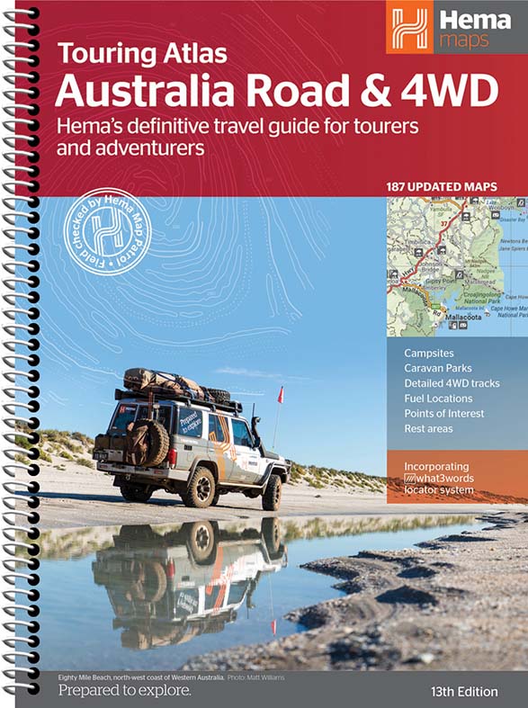


Description
Featuring trusted Hema mapping for all of Australia, the Hema Road & 4WD Touring Atlas is the definitive travel guide for tourers and adventurers. Hema atlases feature more information useful to travellers, including 4WD tracks, campsites, caravan parks, rest areas, 24-hour fuel and points of interest.
This edition contains more mapping than ever before, which is enhanced by a striking new cartographic style that's incredibly easy to read. Included in this is up-to-date mapping for Australia's biggest 4WD destinations: Cape York, Fraser Island, the Top End, the Kimberley, the Pilbara, Central Australia, High Country Victoria and the Flinders Ranges.
A handy distance grid, national park guide, list of accredited information centres and a complete index are also included to assist with trip planning and navigation, making it the perfect tool for guiding tourers, campers, road trippers and off-roaders throughout Australia.
Key Features
- Detailed 4WD tracks
- Fuel
- Points of interest
- National parks
- Campsites
- Caravan parks
- Rest areas
- Road distances
- Fully indexed
Key Specifications
Edition: 13th, Publication Date: 31/01/22, Number of Pages: 224, Height: 297mm, Width: 215mm, Depth: 15mm, Weight: 1.34kg
WHY WE LOVE HEMA MAPS...
Hema Maps is an Australian based mapping and publishing company that was founded in 1983. The company has expanded purposefully to the point where today it has comprehensive Australia and overseas map coverage in a variety of forms including folded maps, atlases, guides and digital products such as apps and dedicated GPS navigation systems.
With a keen focus on off-road touring, Hema Maps has steadily built its reputation as masterful map makers in the four-wheel driving and outdoor adventure industries. This reputation has come to the fore thanks to the company’s relentless pursuit of accurate cartographic detail relevant to outdoor explorers, realised by its unparalleled updating process.
The job of collecting and updating this data falls to field-teams known as the Map Patrol, who are responsible for exploring and mapping the vast array of off-road destinations in Australia to keep Hema Maps’ data accurate and up-to-date. Since 1996, Hema Maps has GPS mapped over 690,000km of tracks and 545,000km of unsealed roads throughout Australia, and will continue to pursue premium quality and accuracy within its product range into the foreseeable future.
You may also like
Sustain, Support & Explore
Eco-Friendly Packaging
Choose the Conron Store for eco-friendly packaging that's kind to the Earth.
Supporting Aussie Brands
We proudly support Aussie brands, nurturing local innovation and quality.
Embracing Outdoor Activities
Join us in spending 2 hours outside, 2 days a week, for a healthier lifestyle.